Faculty & Staff
Xie Hu
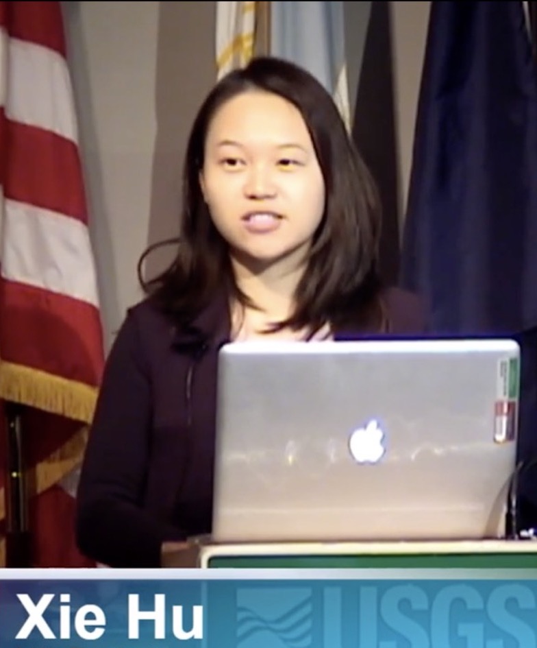
Xie Hu
Title:Tenure-track Assistant Professor
Research Direction:SAR remote sensing | Geohazards | Surface/shallow processes
Department:Department of Physical Geography and Natural Resources
Email:hu.xie@pku.edu.cn
I am the PI of the Natural Hazards Remote Sensing Lab (NHRS) at Peking University. We focus on using remote sensing tools, e.g., Synthetic Aperture Radar (SAR), to characterize ground deformation and land alternations associated with geohazards and surface processes in terrestrial planets. We have been working on mapping, measuring, and monitoring landslides, aquifers, dams, mines, coasts, earthquakes, extreme precipitation events, etc. We are also dedicated to investigating their natural or anthropogenic triggerings and environmental forcings using statistical, analytical, numerical models and artificial intelligence (AI). Our multidisciplinary research spans the fields of geomatics, geophysics, hydrology, geology, tectonics, climate change, civil and environmental engineering, and computer science.
I am looking for highly motivated undergraduate and graduate students and postdoctoral researchers who are intesrested in or have research experience in AI | remote sensing | geophysical models. Research topics on landslides, coastal resilience, and other aspects of geohazards and surface/shallow processes are welcome and supported. The successful applicants should have a strong background in mathematics and have some programming skills. Please email me if you are strongly interested and engaged to learn!
Education
2014-2018 Ph.D. in Geophysics Southern Methodist Univ. (SMU), Dallas, TX, USA
Working experience
7/2021- Tenure-track Assistant Professor Peking University
8/2020-6/2021 Tenure-track Assistant Professor University of Houston
9/2018-8/2020 Postdoctoral Researcher University of California, Berkeley
2014-2018 Graduate Research Assistant Southern Methodist University
2013 Research Assistant King Abdullah University of Science and Technology
Selected Awards
2022 AGU Natural Hazards Early Career Award
2021 NASA New (Early Career) Investigator Program in Earth Science
2018 Chinese government award for outstanding self-finance students abroad
2015 NASA Earth and Space Science Fellowship
Selected Grants
2022-2025 Joint DLR-INTA Scientific Announcement of Opportunity (PI)
Joint TSX/TDX/PAZ Characterization of Mountain Excavation and City Construction
2022-2025 The 3rd Research Announcement on the Earth Observations (60 scenes quota; PI)
Slow-moving Landslide Characterization Using SAR Remote Sensing
2021-2023 Utilization of TerraSAR-X / TanDEM-X Data for Scientific Use (150 scenes quota; PI)
High-accuracy land deformation and surface change mapping for coastal resilience
2021-2024 NASA New (Early Career) Investigator Program in Earth Science ($375,000; PI)
Four-dimensional landslide quantification in the Western U.S. using remote sensing big data
2020-2021 Southern California Earthquake Center (SCEC) ($20,217; Co-I)
Separation of tectonic, hydrological and anthropogenic sources of ground deformation in Southern California
2018-2021 California Energy Commission Program grant ($148,626; PI)
Development of an integrated methodology for assessing integrity of levees protecting natural gas infrastructure
2015-2019 NASA Earth Surface & Interior Program grant ($210,097; PI)
Environmental controls on landslide motion revealed by InSAR and pixel offset tracking
2015-2018 NASA Earth and Space Science Fellowship ($104,894; PI)
Quantifying landslide dynamics using InSAR: applications to landslides in northwestern USA
Courses
Special Topics on Microwave Remote Sensing Graduate 2023F
SAR Remote Sensing (3 credits) Graduate 2023S
Advanced GIS Techniques and Applications (3 credits) Undergrad 2022F | 2023F
CIVE 7397 SAR Remote Sensing (3 credits) Graduate 2020 Fall @ University of Houston
Journal Publications
† Student/postdoc advisee *Corresponding
36. Ao, Z., Hu, X.L., Tao, S.*, Hu, X., Wang, G., Li, M., Wang, F., Hu, L., Liang, X., Qi, W., Ran, Q., Yusup, A., Xiao, J., Fang, J., Chang, J., Zeng, Z., Fu, Y., Xue, B., Wang, P., Zhao, K., Li, L., Li, W., Li, Y., Jiang, M., Yang, Y., Shen, H., Zhao, X., Shi, Y., Wu, B., Yan, Z., Wang, M., Su, Y., Hu, T., Ma, Q., Bai, H., Wang, L., Yang, Z., Feng, Y., Zhang, D., Huang, E., Pan, J., Ye, H., Yang, C., Qin, Y., He, C., Guo, Y., Cheng, K., Ren, Y., Yang, H., Zheng, C., Zhu, J., Wang, S., Ji, C., Zhu, B., Liu, H., Tang, Z., Wang, Z., Zhao, S., Tang, Y., Xing, H., Guo, Q., Liu, Y., Fang, J., 2024. A national-scale assessment of land subsidence in China’s major cities. Science, 384(6693), 301-306. https://doi.org/10.1126/science.adl4366
35. Li, X., Yu, X.†, Burgi, P., Wald, D., Hu, X., Xu, S.*, 2024. Rapid Building Damage Estimates from the M7.8 Turkey Earthquake sequence via Causality-informed Bayesian Inference from Satellite Imagery. Earthquake Spectra (Accepted)
34. Ye, X., Zhu, H.H.*, Wu, B., Tian, F., Zhang, W., Hu, X., Schenato, L., Pasuto, A., Catani, F., 2024. Near-surface soil hydrothermal response feedbacks landslide activity and mechanism. Engineering Geology (Accepted)
33. Zhou, C., Cao, Y.*, Gan, L., Wang, Y., Motagh, M., Roessner, S., Hu, X., Yin, K., 2024. A novel framework for landslide displacement prediction using MT-InSAR and machine learning techniques. Engineering Geology, 334, 107497. https://doi.org/10.1016/j.enggeo.2024.107497
32. Thomas, J., Klida, R., Oommen, T.*, Sajinkumar, K.S., Zhang, B., Hu, X., 2024. Need for a multi-sensor monitoring approach for embankment failures: lessons learned from the Edenville Dam failure. Environmental & Engineering Geoscience, 30(1-2), 19–30. https://doi.org/10.21663/EEG-D-23-00056
31. Li, Y., Cui, Y.*, Hu, X., Lu, Z., Guo, J., Wang, Y., Wang, H., Wang, S., Zhou, X., 2024. Glacier retreat in Eastern Himalaya drives catastrophic glacier hazard chain. Geophysical Research Letters, 51, e2024GL108202. https://doi.org/10.1029/2024GL108202
30. Welch, J., Wang, G.*, Bao, Y., Zhang, S., Huang, G., Hu, X., 2024. Unveiling the hidden threat: drought-induced inelastic subsidence in expansive soils. Geophysical Research Letters, 51, e2023GL107549. https://doi.org/10.1029/2023GL107549
29. Yu, X.†, Hu, X.*, Song, Y.†, Xu, S., Li, X., Song, X., Fan, X., Wang, F., 2024. Intelligent assessment of land surface damage in 2023 Turkey-Syria Earthquake by multiple remote sensing observations. npj Natural Hazards, 1, 3. https://doi.org/10.1038/s44304-024-00003-0
28. Chen, X.*, Xu, X., Ma, Y.*, Wang, G., Chen, D., Cao, D., Xu, X., Zhang, Q., Li, L., Liu, Y., Liu, L., Li, M., Luo, S., Wang, X., Hu, X., 2024. Investigation of precipitation process in the water vapor channel of the Yarlung Zsangbo Grand Canyon. Bulletin of the American Meteorological Society, E370–E386. https://doi.org/10.1175/BAMS-D-23-0120.2
27. Wang, F.*, Xue, P., Su, W., Hu, X., 2024. The locality-adaptation theory of traditional villages. Indoor and Built Environment, 86, 171–180. https://doi.org/10.1177/1420326X241234171
26. Yang, L., Lu, Z., Ouyang, C., Zhao, C.*, Hu, X., Zhang, Q., 2023. Glacial lake outburst hazard monitoring and flooding modeling by integrating multiple remote sensing methods and HEC-RAS. Remote Sensing, 15(22), 5327. https://doi.org/10.3390/rs15225327
25. Zheng, W., Hu, J.*, Lu, Z., Hu, X., Sun, Q., Liu, J., Zhu, J., Li, Z., 2023. Enhanced kinematic inversion of 3-D displacements, geometry, and hydraulic properties of a north-south slow-moving landslide in Three Gorges Reservoir. Journal of Geophysical Research: Solid Earth, 128, e2022JB026232. https://doi.org/10.1029/2022JB026232
24. Shi, X., Hu, X.*, 2023. Characterization of landslide displacements in an active fault zone in Northwest China. Earth Surface Processes and Landforms. https://doi.org/10.1002/esp.5594
23. Yu, X.†*, Wang, G., Hu, X., Liu, Y., Bao, Y., 2023. Land subsidence in Tianjin, China: before and after the South-to-North Water Diversion. Remote Sensing, 15(6), 1647. https://doi.org/10.3390/rs15061647
22. Li, X., Dimasaka, J., Zhang, X., Yu, X.†, Wang, C., Hu, X., Noh, H. Y., Zhao, X., Xu, S.*, 2023. Seismic impacts report for M7.8 and M7.5 Turkey-Syria earthquake using near real-time crowdsourcing and remote sensing information. DesignSafe-CI.
21. Qi, S.*, Hou, X., Yu, Y., Zhang, Y., Hu, X., Zhang, L., Li, Z., Guo, S., Zhang, F., Li, T., Peng, J., 2022. Collapse and subsidence mechanism of compacted loess and suitability of mountain bulldozing and city creation projects in the Loess Plateau of China. Science Bulletin.
20. Yu, X.†, Hu, X.*, Wang, G., Wang, K., Chen, X., 2022. Machine-learning estimation of snow depth in 2021 Texas statewide winter storm using SAR imagery. Geophysical Research Letters, 49, e2022GL099119. https://doi.org/10.1029/2022GL099119
19. Zhou, C., Cao, Y., Hu, X., Yin, K.*, Wang, Y., Catani, F., 2022, Enhanced dynamic landslide hazard assessment using MT-InSAR method in the Three Gorges Reservoir Area. Landslides, 19, 1585–1597 (2022). https://doi.org/10.1007/s10346-021-01796-1
18. Hu, X.*, Xue, L., Bürgmann, R., Fu, Y., 2021, Stress perturbations from hydrological and industrial loads and seismicity in the Salt Lake City region. Journal of Geophysical Research: Solid Earth, 126, e2021JB022362. https://doi.org/10.1029/2021JB022362
17. Hu, X.*, Bürgmann, R., Fielding, E.J., Xu, X., Zhen, L., 2021, Machine-learning characterization of tectonic, hydrological and anthropogenic sources of active ground deformation in California. Journal of Geophysical Research: Solid Earth, 126, e2021JB022373. https://doi.org/10.1029/2021JB022373
16. Hu, X.*, Liang, X., Yu, Y., Guo, S., Cui, Y., Li, Y., Qi, S., 2021, Remote sensing characterization of Mountain Excavation and City Construction in Loess Plateau. Geophysical Research Letters, 48, e2021GL095230. https://doi.org/10.1029/2021GL095230
15. Shi, X.G., Hu, X.*, Sitar, N., Kayen, R., Qi, S., Jiang, H., Wang, X., 2021, Hydrological control shift from river level to rainfall in the reactivated Guobu Slope besides the Laxiwa hydropower station (China). Remote Sensing of Environment, 265, 112664. https://doi.org/10.1016/j.rse.2021.112664
14. Yu, H.†, Hu, X., 2021, Knowledge-aided InSAR phase unwrapping approach. IEEE Transactions on Geoscience and Remote Sensing. https://doi.org/10.1109/TGRS.2021.3081039
13. Shi, G.Q., Ma, P.*, Hu, X., Song, X., Huang, B., Lin, H., 2021, Surface response and subsurface features during the restriction of groundwater exploitation in Suzhou (China) inferred from decadal SAR interferometry. Remote Sensing of Environment, 256, 112327. https://doi.org/10.1016/j.rse.2021.112327
12. Shi, Z.M., Hu, X., Wang, C.-Y.*, 2021, Hydro-mechanical coupling in the shallow crust – insight from groundwater level and satellite radar imagery in a mining area. Journal of Hydrology, 594, 125649. https://doi.org/10.1016/j.jhydrol.2020.125649
11. Hu, X.*, Bürgmann, R., Schulz, W., Fielding, E.J., 2020, Four-dimensional surface motions of the Slumgullion landslide and quantification of hydrometeorological forcing. Nature Communications, 11, 2792. https://doi.org/10.1038/s41467-020-16617-7
10. Hu, X.*, Bürgmann, R., 2020, Aquifer deformation and active faulting in Salt Lake Valley, Utah, USA. Earth and Planetary Science Letters, 547. https://doi.org/10.1016/j.epsl.2020.116471
9. Hu, X.*, Bürgmann, R., Fielding, E.J., Lee, H., 2020, Internal kinematics of the Slumgullion landslide (USA) from high-resolution UAVSAR InSAR data. Remote Sensing of Environment, 251. https://doi.org/10.1016/j.rse.2020.112057
8. Hu, X.*, Bürgmann, R., 2020, Rheology of a debris slide from the joint analysis of UAVSAR and LiDAR data. Geophysical Research Letters, 47, e2020GL087452. https://doi.org/10.1029/2020GL087452
7. Hu, X.*, Bürgmann, R., Lu, Z., Handwerger, A. L., Wang, T., Miao, R., 2019, Mobility, thickness, and hydraulic diffusivity of the slow-moving Monroe landslide in California revealed by L-band satellite radar interferometry. Journal of Geophysical Research: Solid Earth, 124. https://doi.org/10.1029/2019JB017560
6. Hu, X.*, Lu, Z., Wang, T., 2018, Characterization of hydrogeological properties in Salt Lake Valley, Utah using InSAR. Journal of Geophysical Research: Earth Surface, 123. https://doi.org/10.1029/2017JF004497
5. Hu, X.*, Lu, Z., Pierson, T. C., Kramer, R., George, D. L., 2018, Combining InSAR and GPS to determine transient movement and thickness of a seasonally active low‐gradient translational landslide. Geophysical Research Letters, 45, 1453–1462. https://doi.org/10.1002/2017GL076623
4. Hu, X., Oommen, T., Lu, Z.*, Wang, T., Kim, J. W., 2017, Consolidation settlement of Salt Lake County tailings impoundment revealed by time-series InSAR observations from multiple radar satellites. Remote Sensing of Environment, 202, 199–209. https://doi.org/10.1016/j.rse.2017.05.023
3. Hu, X., Wang, T., Pierson, T. C., Lu, Z.*, Kim, J. W., Cecere, T. H., 2016, Detecting seasonal landslide movement within the Cascade landslide complex (Washington) using time-series SAR imagery. Remote Sensing of Environment, 187, 49–61. https://doi.org/10.1016/j.rse.2016.10.006
2. Kim, J.W., Lu, Z.*, Qu, F., Hu, X., 2015, Pre-2014 mudslides at Oso revealed by InSAR and multi-source DEM analysis. Geomatics, Natural Hazards and Risk, 6(3), 184–194. https://doi.org/10.1080/19475705.2015.1016556
1. Hu, X., Wang, T, Liao, M., 2014, Measuring coseismic displacements with point-like targets offset tracking. IEEE Geoscience and Remote Sensing Letters, 11(1), 283–287. https://doi.org/10.1109/LGRS.2013.2256104